Review for "Mosaic X5 GNSS RTK CORS Fanless Station"
Mosaic X5 GNSS RTK CORS Fanless Station
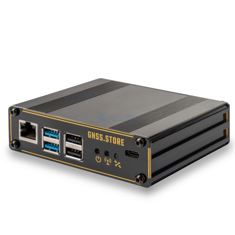
Mosaic X5 GNSS RTK CORS Station based on Raspberry PI4 with optional PoE support. The ELT_RtkBase software support NTRIP server, NTRIP caster, TCP server and TCP client connections and data logging, RTCM3 and RINEX data formats. Direct support for Onocoy and RTK Direct services, local database for hundreds of rovers. Four different methods for base coordinates detection. Detailed documentation for entry level customers, fast and easy setup. Open source software, custom modification possible. This product comes with 1 years worldwide warranty
Mosaic X5 GNSS RTK CORS Station based on Raspberry PI4 with optional PoE support. The ELT_RtkBase software support NTRIP server, NTRIP caster, TCP server and TCP client connections and data logging, RTCM3 and RINEX data formats. Direct support for Onocoy and RTK Direct services, local database for hundreds of rovers. Four different methods for base coordinates detection. Detailed documentation for entry level customers, fast and easy setup. Open source software, custom modification possible. This product comes with 1 years worldwide warranty
Review
 0 of 0 people found the following review helpful
Total Rating:
Very pleased with the basestation. Easy to setup. I am a novice in this.
I have a few questions however:
I have tried CSRS-PPP (data collection for 24 h.) and the build in PPP that converges. They seem to agree on longitude and lattitude however elevation differes a lot some 80 cm. Are they using different references? In my country we use DVR50 - I have a geoid .gtx file use to correct on my rover however here there is a consistent approx 20 cm difference when useing the CSRS-PPP for the basepoint, when compared to some know points I have from a professional surveyor. I have set pole height etc.
Any pointers?